
GEOGRAPHICAL INFORMATION SYSTEMS
We use GIS tools to inform decision making through geospatial analysis techniques
GEOGRAPHICAL INFORMATION SYSTEMS
We use GIS tools to inform decision making through geospatial analysis techniques
USE OF GIS FOR SAMPLE DESIGN AND OPERATIONS
GIS tools have proved a valuable resource to support survey design and implementation, and are a key factor to ensure high-quality standards. They may be utilized during the sample design, fieldwork operations and field supervision, enabling the following features:
01
Sample Design
- Facilitate spatial stratification based on satellite imagery for household surveys
- Support segmentation of large area sampling units
- Assist the execution and supervision of listing operations
- Facilitate stratification by size of production units, type of soil, type of crop, etc. in agricultural surveys
- Allow for more efficient measurement of cultivated areas
02
Field Implementation
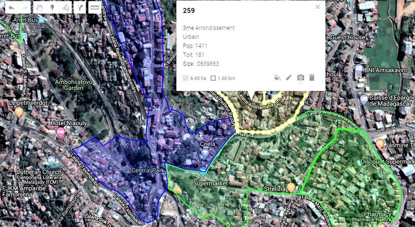
- Record building geographical coordinates during the listing operation for supervision purposes
- Back up interviewers in the field to locate assigned buildings to be visited, especially in settings where no complete addresses exist
03
Field Supervision
- Support supervision of field staff by monitoring their location in real time
- Enhance the control of unit nonresponse
USE OF GIS FOR SAMPLE DESIGN AND OPERATIONS
GIS tools have proved a valuable resource to support survey design and implementation, and are a key factor to ensure high-quality standards. They may be utilized during the sample design, fieldwork operations and field supervision, enabling the following features:
01
Sample Design
- Facilitate spatial stratification based on satellite imagery for household surveys
- Support segmentation of large area sampling units
- Assist the execution and supervision of listing operations
- Facilitate stratification by size of production units, type of soil, type of crop, etc. in agricultural surveys
- Allow for more efficient measurement of cultivated areas in agricultural surveys
02
Field Implementation
- Record building geographical coordinates during the listing operation for supervision purposes
- Back up interviewers in the field to locate assigned buildings to be visited, especially in settings where no complete addresses exist
03
Field Supervision
- Support supervision of field staff by monitoring their location in real time
- Enhance the control of unit nonresponse
ANALYSIS & visualization
In addition to their use in sample design and field operations, GIS tools can support informed decision making and public policy formulation through a range of geospatial analysis and visualization techniques:
04
Poverty and other thematic maps
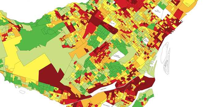
They show the spatial distribution of one or more specific data themes, such as poverty, density of immigrant populations, housing construction characteristics, water quality, predominant crops cultivated, etc. They are typically based on census data and can be used for exploratory spatial data analysis and synthesizing spatial data by revealing patterns and relationships.
05
Risk mapping
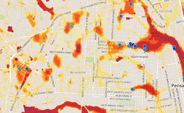
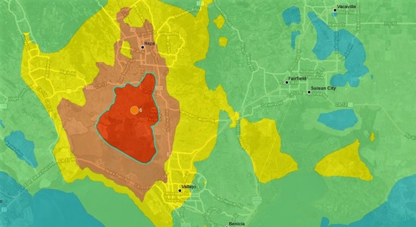
This tool can help identify geographic zones vulnerable to hazards such as floods, hurricanes, or fires. The perspective allows for prioritizing preventive measures.
06
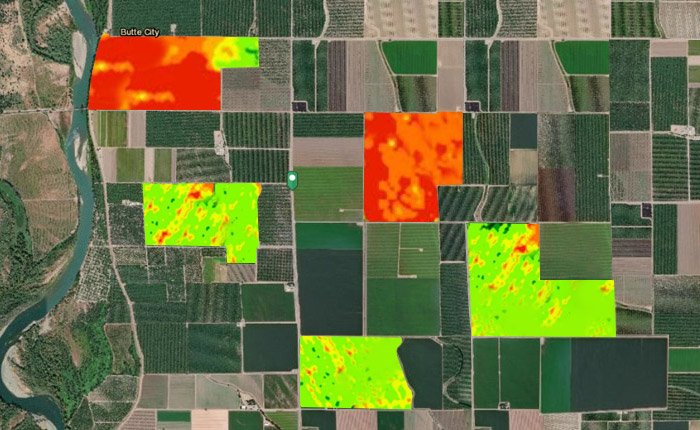
Remote sensing
Satellite or drone-based sensor technologies can produce geospatial information based on propagated signals. This sensing can be used to identify and classify objects such as water bodies, buildings, and agricultural plots by type of cultivated crops.
ANALYSIS & visualization
In addition to their use in sample design and field operations, GIS tools can support informed decision making and public policy formulation through a range of geospatial analysis and visualization techniques:
04
Poverty and other thematic maps
These maps show the spatial distribution of one or more specific data themes, such as poverty, density of immigrant populations, housing construction characteristics, water quality, predominant crops cultivated, etc. They are typically based on census data and can be used for exploratory spatial data analysis, confirming hypotheses and synthesizing spatial data by revealing patterns and relationships. They can also support development of research and survey questions.
05
Risk mapping
This tool can help identify geographic zones vulnerable to hazards such as floods, hurricanes, or fires. The perspective allows for prioritizing preventive measures.Â
06
Remote sensing
Satellite or drone-based sensor technologies can produce geospatial information based on propagated signals. This sensing can be used to identify and classify objects such as water bodies, buildings, and agricultural plots by type of cultivated crops.
Address
Jose M de la Barra 412, piso 4
Postcode 6500446
Santiago, Chile
Phone
+562 2638 1841
+562 2639 4554
Sistemas Integrales 2018 - All Rights Reserved
Address
Jose M de la Barra 412, piso 4
Postcode 6500446
Santiago, Chile
Phone
+562 2638 1841
+562 2639 4554
Sistemas Integrales 2018 – All Rights Reserved